Around 250
objects of historical and cultural interest are on display in the "The
Arctic – While the Ice is Melting" exhibition at the Nordiska Museet in
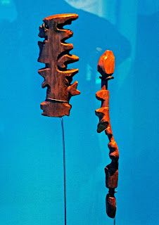
Stockholm. The most interesting exhibited items are the copies of carved wooden
maps from 1883.
Cut-out
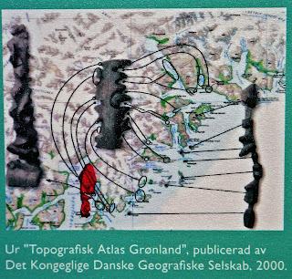
wooden maps were used in the 19th century in eastern Greenland. The
maps are three-dimensional images of specific places.
One
represents the coast and the other a band of islands outside the mouth of a
fjord.
The maps
are small and easy to carry in the pocket. They could fall in the water and
float without being damaged – told us Daniel Thorleifsen, director of the
Greenland National Museum and Archives.


No comments:
Post a Comment